
GIS and Immersive Content for Operational Digital Twins
GIS and Immersive Content for Operational Digital Twins
ASFAN combines geographic information systems with immersive rooms, projection walls, terrain data, and environmental simulation to help teams explore operational digital twins and spatial information in a shared interactive space.
GIS and Immersive Content for Operational Digital Twins
ASFAN's GIS and Immersive Content for Operational Digital Twins solution is designed for researchers, planners, trainers, and decision-makers who need to understand terrain, environmental data, and spatial scenarios in a shared visual environment.
Three large-format projection walls create a 270° field of view, while synchronized HD projectors and precision motion sensors enable real-time interaction with imported terrain data, GeoTIFF files, coordinates, and simulation scenarios.
How It Works
01 Select Region
Choose the target geographic region of Jordan from the interactive map.
02 Enter Coordinates
Input latitude and longitude using dedicated coordinate fields.
03 Set Chunk Size
Define the data tile size in kilometers for the required resolution.
04 Import GeoTIFF
Load terrain data and activate the required coordinate reference system.
SIMULATION MODES
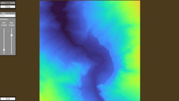
No Simulation - Data Preview
Preview imported terrain data, customize the color ramp, and fine-tune elevation rendering for clearer presentation.
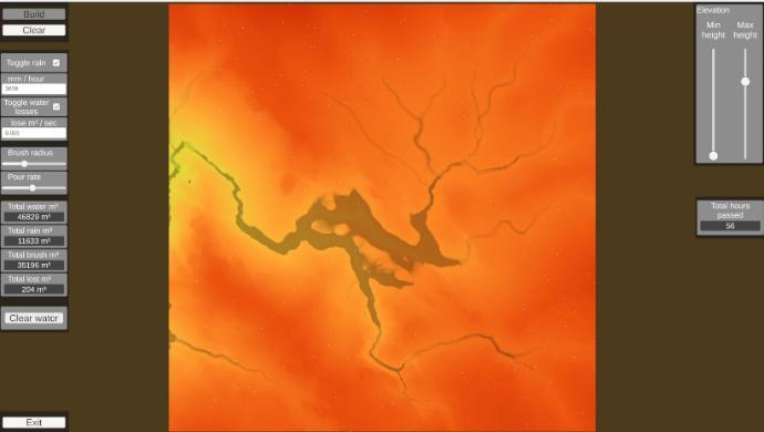
Water & Rain Simulation
Simulate rainfall, water flow, drainage, absorption, and manual water placement across terrain.
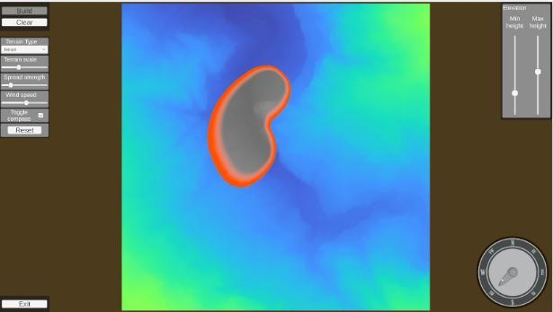
Fire & Wildfire Simulation
Model ignition and spread with terrain type, spread strength, wind speed, and wind direction controls.
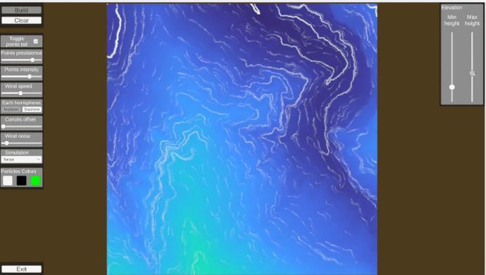
Wind & Pollution Simulation
Control wind speed, direction, and altitude while injecting pollution sources to observe dispersion in real time.
Built for Spatial Awareness
The GIS and immersive content platform supports environmental risk review, research and planning support, emergency preparedness, and interactive training where teams need to see terrain behavior together instead of relying on flat maps.
View GIS and Immersive Content for Operational Digital Twins PDF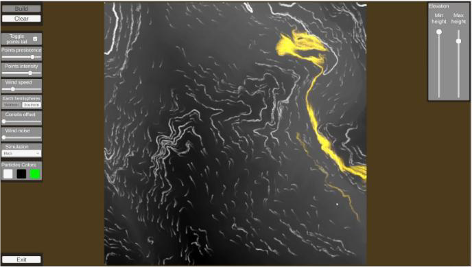
Ready to simulate terrain inside an immersive room
Start the conversation- Three-wall immersive projection environment
- Terrain, water, fire, wind, and pollution simulation modes
- GeoTIFF import, coordinates, and interactive region setup
Client & Visitor Reviews
Share your experience, feedback, or opinion about this page content.
Write a Review
Latest Reviews